


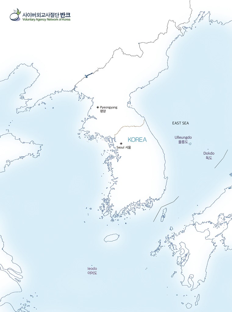
VANK made a poster to promote Korean maritime territories.
Maritime territory is a term that includes the territorial sea, the EEZ, and the continental shelf, which the sovereignty and sovereign rights that Korea has. When you search a Japanese map on Google, the map introduces almost all of the maritime territories, whereas the Korean map does not properly show the maritime territories.
Therefore, it is necessary to properly inform the world of Korea’s map, which depicts the maritime regions of our sovereignty.
Above all, Korea’s neighboring countries, Japan and China, have a high interest in maritime territories, and the Northeast Asia is in a situation where conflicts and tensions are increasing with the Air Defense Identification Zones.
While Koreans are not interested in this, Japan and China are actively promoting maritime territories to the world, and for this reason, Dokdo and other Korean territories are not properly known to the international community.
Therefore, Korea should also actively promote maps that contain all the seas and lands of maritime territorial sovereignty, including EEZ and continental shelf limits.
Accordingly, VANK created four digital English Korean maps that reflect the Korean maritime territories such as Ulleungdo, Dokdo and Ieodo, to notify the world about Korean maritime territories..